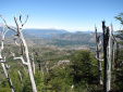
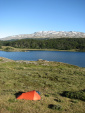
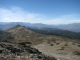
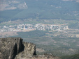
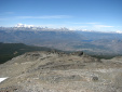
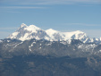
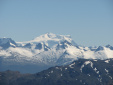
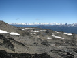
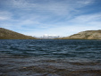
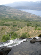
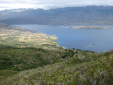
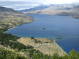
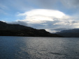
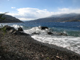
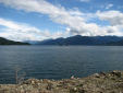
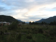
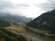
| Als nðchstes bin ich die Carretera Austral weiter nach Norden gefahren, und habe mir unterwegs einige Regionen angeschaut. Die Carretera Austral ist eine fast 1000 km lange Schotterpiste an der chilenischen Seite Patagoniens. Es sind viele Radler unterwegs, die f■r die Strecke ungefðhr 3-4 Wochen brauchen. Die Landschaft ist wundersch—n und abgelegen, man braucht allerdings Zeit, um dort herumzureisen und um erstmal hinzukommen. Meistens fðhrt man durch patagonischen Regenwald an den Pazifik-Fjorden vorbei, mit bis zu 5000 mm Niederschlag pro Jahr. Als erstes habe ich eine 4-Tages-Tour im Tamango-Nationalpark bei Cochrane gemacht, diesmal ganz alleine. Das war auch mal sch—n, 4 Tage allein herumzulaufen, in dem Park ist fast niemand unterwegs! Danach bin ich ■ber Coyhaique und den Queulat-Nationalpark nach Futaleufu gefahren. Dort ist eins der sch—nsten Rafting-Gebiete der Welt. Ich bin zwar kein besonderer Rafting-Fan, aber wenn sich sowas schonmal anbietet, dann will ichs auch ausnutzen! Die lðngere Rafting-Tour geht ■ber zwei Klasse-5-Stromschnellen und acht Klasse-4-Stromschnellen dr■ber, das war schon ordentlich! |
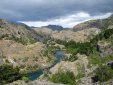
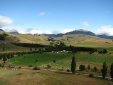
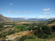
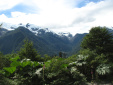
| After Tortel, I traveled the Carretera Austral further north, visiting several regions on the way. The Carretera Austral is a 1000 km long dirt road on the Chilean side of Patagonia. I met a lot of people with bikes, who need about 3-4 weeks to complete the road. The scenery is very beautiful and remote, but it's necessary to have a decent amount of time to travel around and to get there. Most of the time the road heads through Patagonian rainforest next to Pacific fjords, where the precipation can sum up to 5000 mms per year. I did my first trek in this region at the Tamango national park near Cochrane, all by myself this time. It was nice to trek 4 days by my own, almost noone visits this park! Afterwards I traveled via Coyhaique and the Queulat national park to Futaleufu. One of the finest rafting areas of the world is located there. Although I'm not a rafting maniac, I wanted to take this small detour. The longer version of the rafting trip includes two class-5-rapids, and eight class-4-rapids, which was a decent ride! |